The national Park of Snowdonia lies in the northernmost corner of Wales. It separates the Isle of Anglesey, lying off the north west coast, from the rest of the British Isles with deep glacial valleys and the highest peaks in the United Kingdom outside of the Scottish Highlands. One such peak, distinctively pyramidal in appearance and surrounded by accompanying aretes, is that of Snowdon.
Named Yr Wyddfa in the Welsh language, meaning tomb or monument, it is believed to be the final resting place of a king-slaying ogre. This ogre would terrorize those crown-wearing kings who happened to stray into his lands, killing them and making cloaks out of their beards in mockery. The ogres reign of terror came to an end when the legendary King Arthur strode to the top of Snowdon’s peak, and smote down the might ogre, putting the ogre into its final resting place and freeing up the beautiful peak of Snowdon in the process.
After King Arthur’s mountaineering exploits, the next person we know to have climbed Snowdon, or at least written down his experience, is Thomas Pennant in 1781 when he wrote about summiting the peak in his book Tours. There are many routes one can take to get to the summit of Snowdon, and with over half a million visitors a year many clearly do. There is even a train that will chug you to the top a little faster than walking pace and for many it’s the most comfortable way to reach the highest point in English and Wales. For others that want a route with a little more leg stretching, there’s the miners path which guides you through the winding glacial valley carved out millenia ago by solid ice. Following the path used by old miners of the iron in these mountains (an inspiration for the dwarven mountains of middle-earth), the route finally reveals Snowdon, towering behind a glistening glacial lake called Glaslyn before raising you from the valley floor to the mountain’s summit.
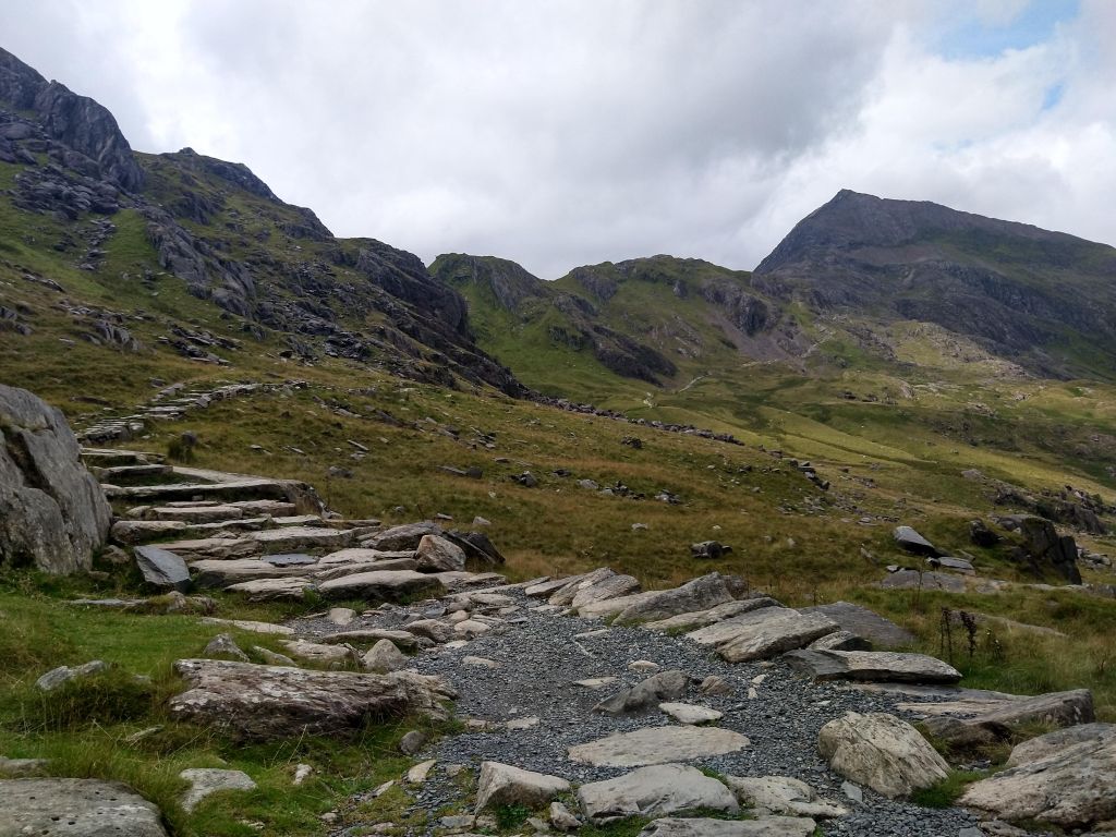
If you’re looking for a little more excitement from Snowdon however and want to avoid most of the crowds, there’s only one route for you. As you leave the Pen-y-pass car park from which most routes start, take the right hand path instead of the miners path and you’ll find yourself on the backside of the Snowdon Horseshoe. From here the path takes you up and over a shoulder in the horseshoe, from where you can rejoin the miners path. However glancing to your right reveals the foreboding cliffs and red ridge of Crib Goch which have loomed over your approach up to this point.
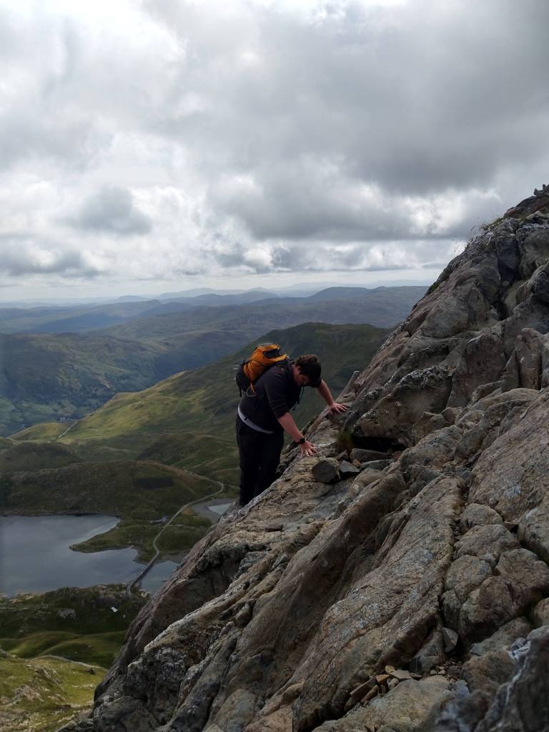
Crib Goch – Red Ridge in Welsh, named for the iron in the rock – is an infamous path to Snowdon’s summit which has unfortunately seen its share of fatal accidents. The razor sharp sections of cliff that need to be traversed in order to make it from arete to arete coupled with the often wet and windy conditions on the mountain make this one of the most treacherous pieces of Grade 1 scrambling in Snowdonia. Before you reach the ridge however one must find a path to it, which can prove more difficult than you’d think if you’re unused to the route or scrambling in general. When I last took this route, we came across a young couple who were heading back down from this first section adamant that there should be a clearly marked path. However their battered trainers and ripped jeans told us that a lack of path may have saved them (and mountain rescue) an unnecessary and potentially unsavoury trip. It’s not uncommon to see walkers on Snowdon in what any seasoned walker would recognise as “unsuitable attire”, but Crib Goch needs to be taken seriously.
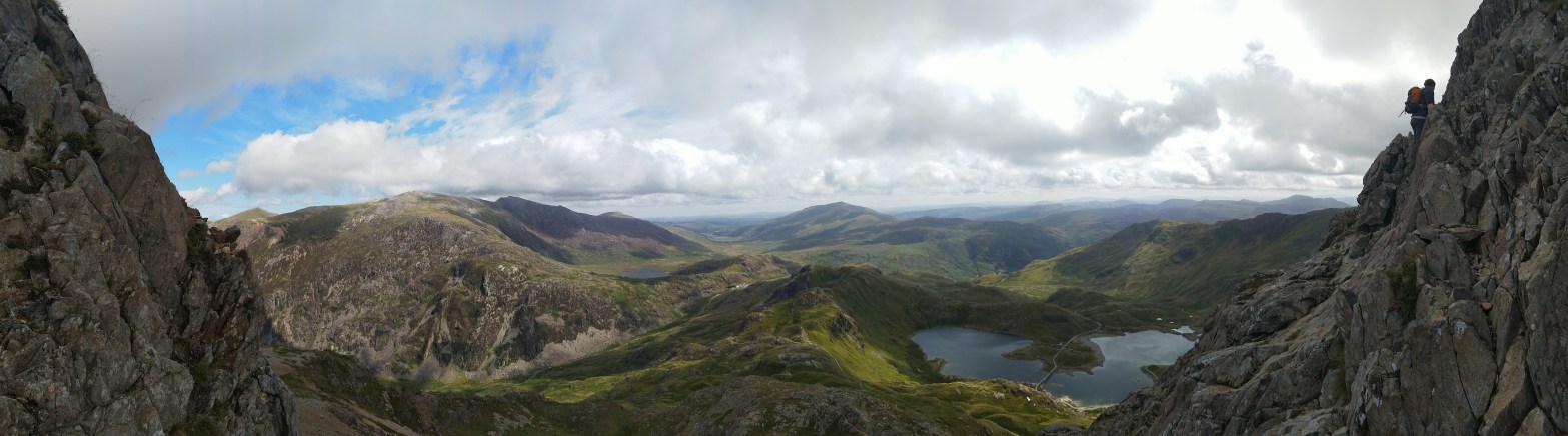
As you clamber up the first cliff face to the beginning of the ridge, be sure to turn around and take in the views of the valleys below before they’re swallowed by clouds. The valley floor sweeps away below you, pulsing as the shifting light makes the landscape seem alive, the smattering of lakes twinkling back from their homes, squeezed in between the raised ridges of the Welsh landscape like a child asleep between sofa cushions. On a clear day this view seems to stretch all the way to England, on a bad day you should probably turn around at this point.
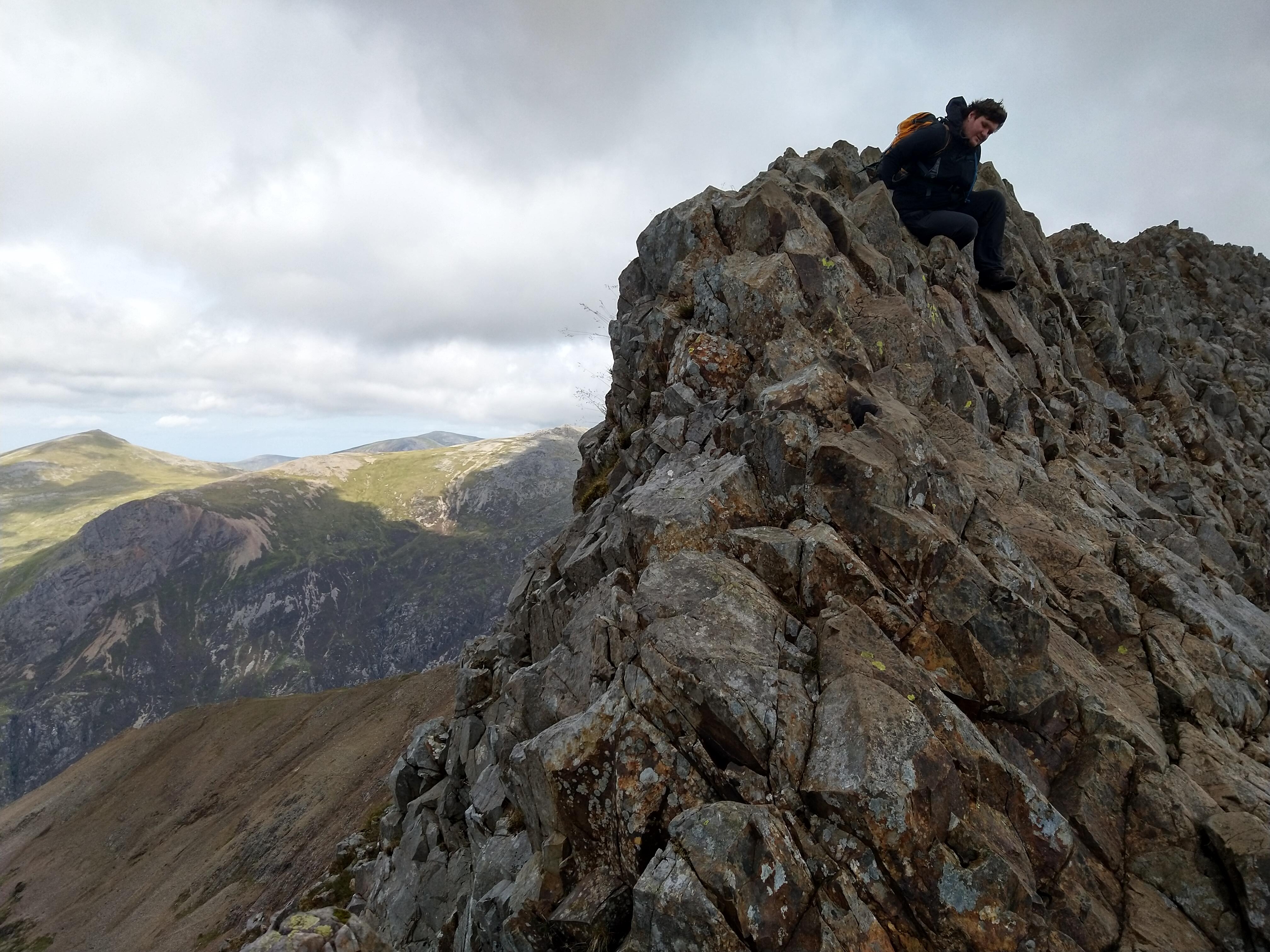
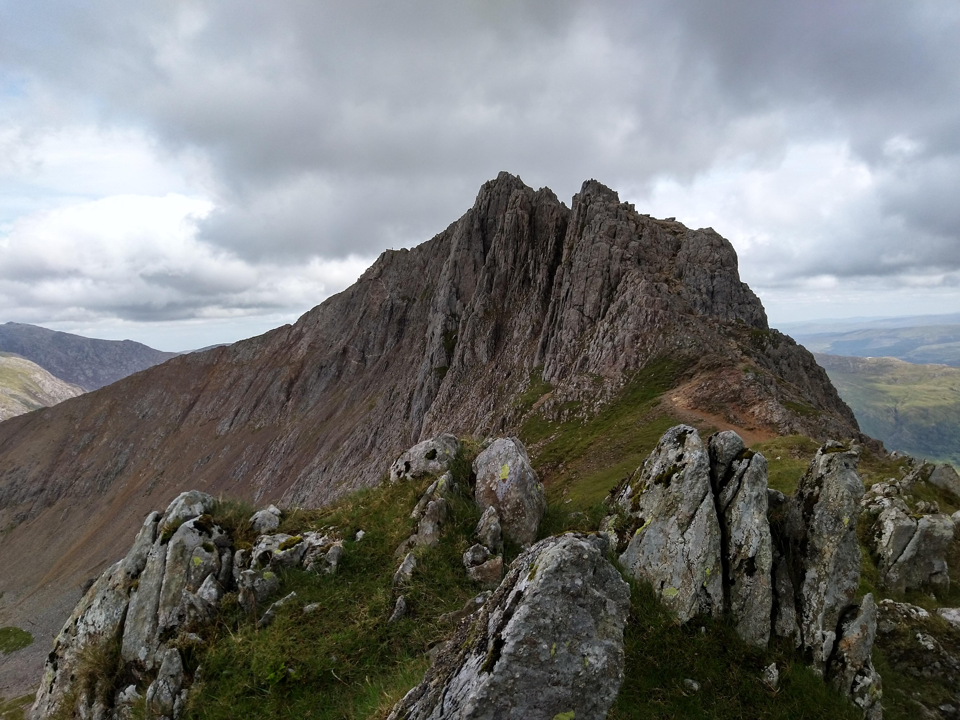
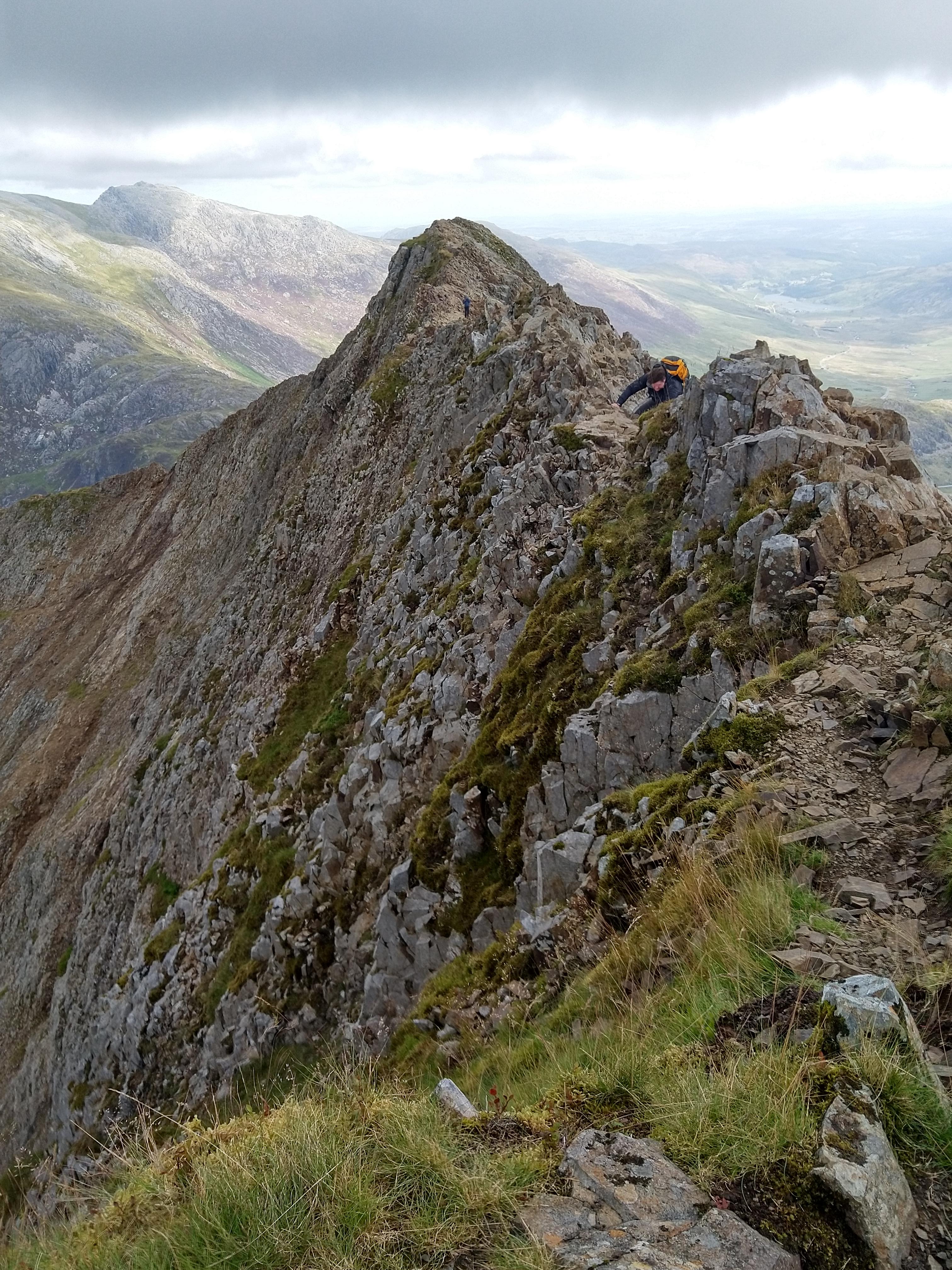
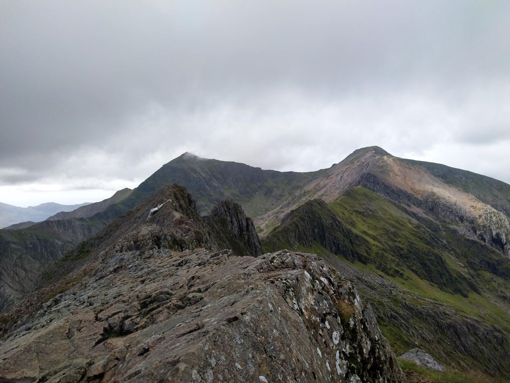
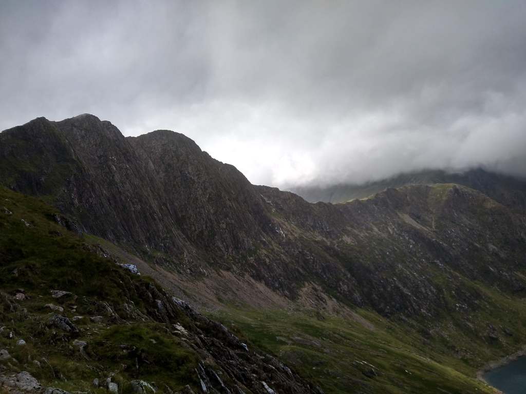
The next section is the ridge itself. Curving ahead towards the aretes of Bwlch Coch and Crib y Ddysgl the jutting rocks form an angular face that one can either straddle or lean into. Usually, sticking to the left hand side is the smartest route. The wind storms in over the ridge left to right and can catch you off guard, sending your heart into your mouth as you catch sight of the steep scree slope that falls away on the right hand side of the ridge, all the way down to the road below. Once you have started along the ridge, the only way down is to either turn around or reach the other side. The angular slopes and loose rocks prohibit any descent until you reach Crib y Ddysgl so be sure to take care choosing your path, having to retrace your steps because of a mistaken route can be costly and time consuming in poor weather conditions, not to mention downright dangerous. The views across to Snowdon from here can be spectacular, with clouds often scraping the mountain’s peak. Wisps of grey and white appear like spray from a giant cresting wave as they drift over, momentarily shrouding those on its summit in characteristically Welsh weather.
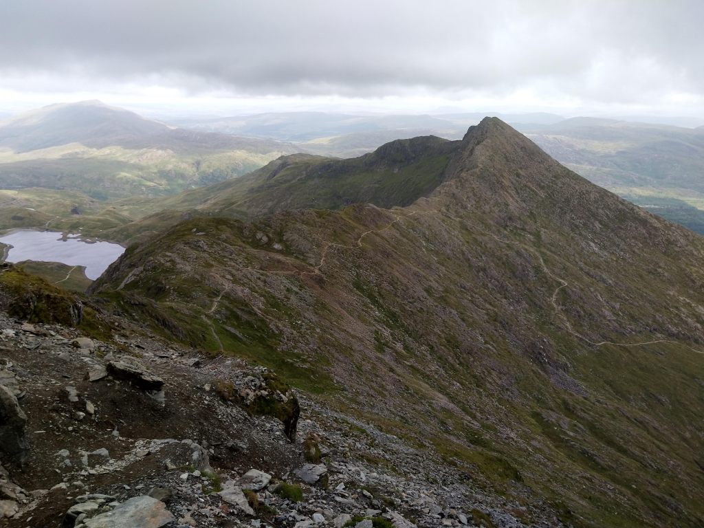
From here the climb to the summit is gradual and fairly uncomplicated. On this stretch you’ll be joining most of the other walkers as they climb the path adjacent to the railway. You will also pass the ever-present queue of people looking to have their picture taken with the much less-present view from Snowden’s trig point. However if you continue past this trailing tail of trekkers and begin your descent down past the visitors centre you soon lose the crowds again. The horseshoe of Snowdon continues around to the equally foreboding cliffs that make up the route’s southern edge. Here the wind blows straight off of the cliffs into the valley below, the blue waters of Glaslyn (which literally means “blue”) often darkened by the clouds that rush in over the precipices of the surrounding peaks and ridges. A careful step is needed if you are venturing to the edge to take in the view and a careful eye is needed to keep between the cairns that make up the scrambling route towards the slopes of Y Lliwedd. It is all too easy to walk too far to your left and end up having to retrace your steps to prevent a very quick descent to the lake below, so make sure to leave yourself plenty of room and don’t just follow those in front, no matter how geared up they seem.
The descent itself is quite straightforward, if not for a few little tricky places. But if you’d have wanted a walk in the park you would have gone for a… well. Coming down from the horseshoe you join up with the miners path. This well paved route is littered with old remnants of the people who used to live and work up here in the mountains. The old pump house bears signs that remind people to not swim in the lakes. The glacial lakes of Snowdonia can be deeper than expected and much colder, the combination of depth and bodily shock being enough in some cases to cause dreadful accidents and sometimes deaths. In the summer months however they can be a welcome respite at the end of a long day of trekking. However, while it was August when we completed this route and took these photos, the lakes were not quite calling to us as much as a warm shower and a welcome fire by our tents. All in preparation for another day of walking in Snowdonia.

One thought on “Walking the Snowdon Horseshoe: Crib Goch to Y Lliwedd”